Summer in the City – Edmonton
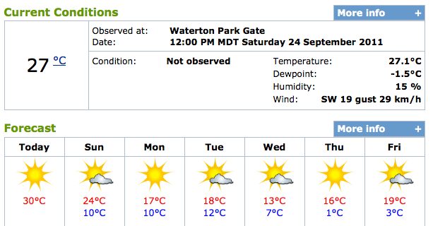
We experience the sunny side of Edmonton after our last two weeks have been rather cool and rainy. We visited Edmonton before, in October 2007, it was cloudy and chilly. I remember wearing a warm jacket. Back then we were not overly enthusiastic about the city. But this time with 28 degrees Celsius and bright …